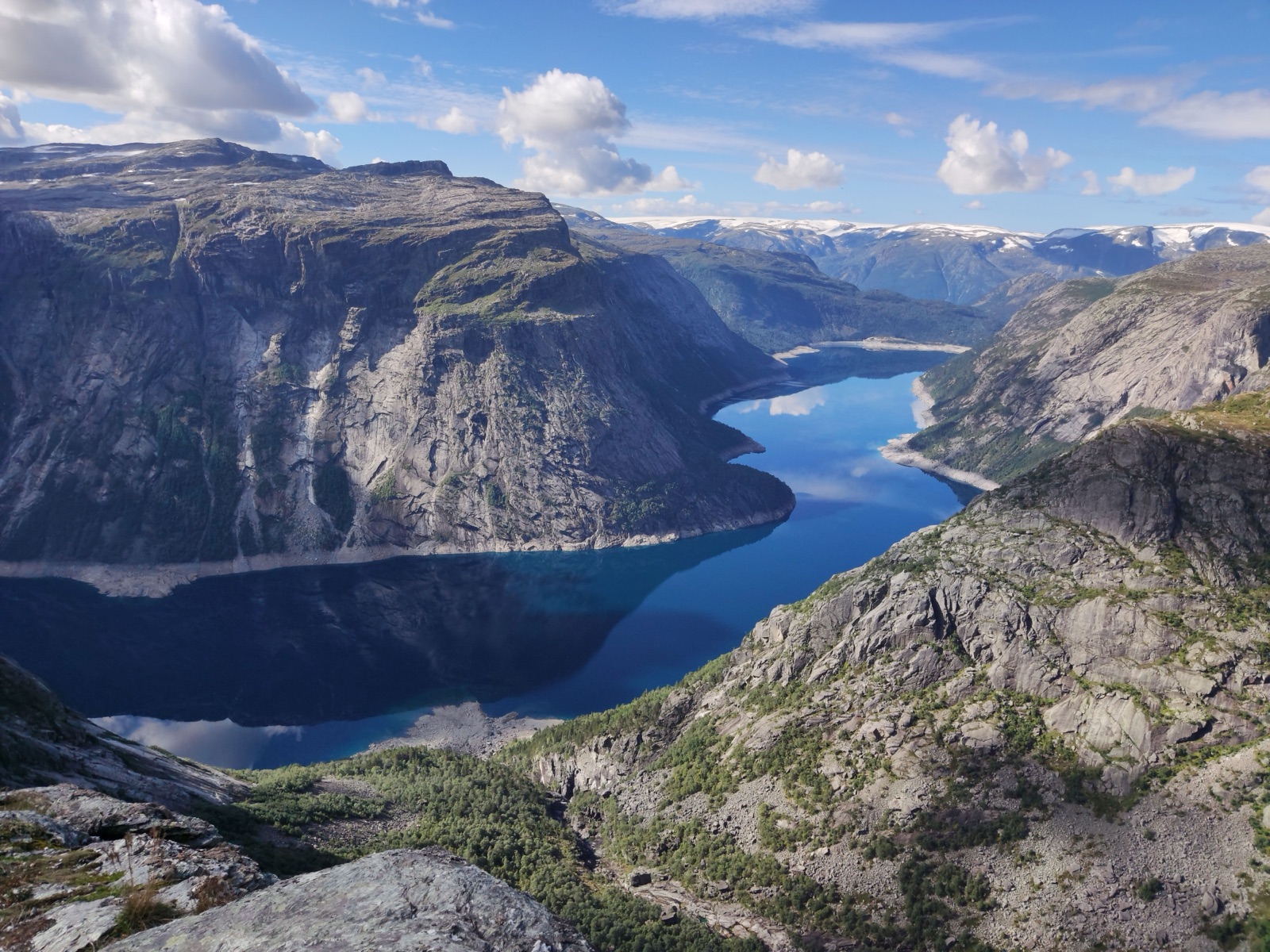
Trolltunga and Preikestolen in One Trip: Routes, Timing and Kjerag Too
Yes, you can do Trolltunga and Preikestolen (Pulpit Rock) on the same trip, but not comfortably on the same day. They are two separate hikes in two different fjord regions: Trolltunga above Odda in Hardanger, Preikestolen on the Lysefjord near Stavanger. Trolltunga AS puts Odda about 4 hours from Stavanger by car, and Trolltunga itself is a 7–12 hour hike. Preikestolen is much shorter, an 8 km round trip of about 4–5 hours. A realistic plan is at least three days: one for Trolltunga, one for the drive south, and one for Preikestolen, with Kjerag as an optional fourth for strong hikers.
Below: how the three hikes compare, the road and bus routes between Odda and the Lysefjord, which order to do them in, a sample itinerary, and the practical details for Preikestolen and Kjerag that differ from Trolltunga.
The three hikes compared
The three are the best-known rock formations of Fjord Norway, and all three are certified Norwegian Scenic Hikes. Trolltunga was the fourth trail to receive the label, after Fosseråsa in Geiranger and Kjerag and Preikestolen on the Lysefjord.
| Trolltunga | Preikestolen | Kjerag | |
|---|---|---|---|
| Region | Hardanger, above Odda | Lysefjord, Strand | Lysefjord, inner end |
| Round trip | 20 km from P3, 27 km from P2 | About 8 km | About 10 km (5 km each way) |
| Time | 7–10 hours from P3, 8–12 from P2 | About 4–5 hours | About 6 hours (3 each way) |
| Height | Ledge at 1,180 m above sea level | Cliff 604 m above the fjord | Boulder at 1032 m above sea level |
| Difficulty | Very Demanding | Moderate | Demanding, with chains |
| Visitors | Around 80,000 a year | Around 350,000 in 2022 | Roughly 50,000 a year |
The difference in effort is the key fact for planning. Preikestolen is a half-day walk on a busy, well-built trail. Kjerag is shorter than Trolltunga but steeper and more exposed, with chains on the hardest sections. Trolltunga is the long one: a full day, graded at the top of the Norwegian scale because it is over 20 km.
Where they are
Trolltunga sits 1,180 metres above sea level east of the village of Tyssedal, in Ullensvang Municipality in Vestland County. The nearest town is Odda, at the head of the Sørfjorden. The hikes start from the car parks at P2 Skjeggedal or P3 Mågelitopp, above Tyssedal.
Preikestolen is a rock plateau on the north side of the Lysefjord in Strand municipality, in Rogaland, east of Stavanger. Its flat top measures roughly 25 by 25 metres. Kjerag is at the inner end of the same fjord, on the south side; its highest point rises to 1132 metres, and its north face drops almost 1,000 metres straight into the water. The famous boulder, Kjeragbolten, is wedged in a crevasse just west of the plateau.
So the two regions are linked, but not close. Hardanger is a long fjord inland of Bergen; the Lysefjord runs inland from Stavanger. Between them lie the mountains and fjords of Ryfylke.
Driving from Odda to the Lysefjord
The road south from Odda is road 13, which Store norske leksikon describes as the main north–south road in Hardanger, running from Voss along the east side of the Sørfjorden to Odda and on to Røldal. It passes the twin waterfall Låtefoss in the Odda valley, about 15 minutes’ drive from Odda.
From Håra near Røldal, the Norwegian Scenic Route Ryfylke takes over. It runs 260 km through the borderland between the archipelago and the highland moors, from Lysefjorden to Sauda and over the mountain pass to Røldal, with two short ferry rides on the way: Nesvik–Hjelmeland and Lauvvika–Oanes. The road climbs to 972 metres above sea level, and sections over the mountain to Røldal are narrow with a number of bends.
Two practical points:
- The mountain road via Sauda closes in winter. The road between Helandsbygd and Røldal (road 520) is closed in winter, and may close at night or in bad weather after it opens. The other branch of the scenic route stays on road 13.
- The Ryfast tunnels link Ryfylke with Stavanger without a ferry. Opened in December 2019, Ryfast includes the Ryfylke tunnel, 14.3 km between Solbakk in Strand and Hundvåg in Stavanger, which Store norske leksikon calls the world’s longest undersea road tunnel.
Trolltunga AS gives about 4 hours by car between Stavanger and Odda. Check ferry times on the day, and in the cold season, from October to April, be sure you and your car are ready for winter driving.
Stops on the drive
The drive south is a sight in itself, so it is worth giving it a full day rather than rushing it. Along road 13 out of Odda, the Odda valley has a string of waterfalls within a few kilometres of each other, with Låtefoss, the twin fall beside the road, as the one most people stop for; traffic over its narrow bridge can move slowly when many visitors stop to take photos. Further south, the Ryfylke scenic route has its own designed rest areas and viewpoints, among them Allmannajuvet, Svandalsfossen, Ropeid, Flesefossen, Høse bru at Sand and Høllesli. Small shore villages such as Sand are good places for a break, and the route’s own description suggests taking your time because it is long and varied.
If you have a spare hour on the way, Odda itself, with its smelting-works history, is worth a short look before you leave, and the Hardangerfjord itself is the backdrop for the first part of the trip if you come from Bergen. The Odda guide and the Låtefoss article have more.
Crowds at both ends
All three hikes are busiest in the same weeks. At Trolltunga the ledge is at its busiest between 12:00 and 15:00 from about 20 June to 20 August; at Preikestolen the car park is busiest from 8 am to 4 pm, especially at weekends and in June, July and August. The answer in both places is the same: start early, avoid Saturdays where you can, and use a weekday for the longest hike. At Trolltunga the first sunny day after several days of rain is also crowded, as everyone who has been waiting for the weather goes at once.
By bus
Without a car the combination is still possible, but slower. Trolltunga AS says NOR-WAY express buses connect Hardanger and Odda with Oslo, Sandefjord, Larvik, Kristiansand, Stavanger and Haugesund, and that several daily bus services link the area with Voss, Bergen, Stavanger and Oslo. The main long-distance route is NOR-WAY’s Haukeliekspressen, which crosses the Haukeli mountain pass between Oslo and Haugesund or Bergen; at Seljestad you can change to buses for Odda. Its summer night buses do not connect with Odda.
At the Stavanger end, Go Fjords runs the Preikestolen Express bus from Stavanger city centre to the start of the Preikestolen trail in about an hour, and a direct bus to Kjerag. Plan the long-distance leg in Norway’s national travel planner, Entur, which Trolltunga AS recommends for timetables and tickets.
For the Odda end in detail, including the shuttle buses from Odda to P2 and from P2 to P3, see getting to Trolltunga.
Flying in and out
The nearest airports to Trolltunga, by Trolltunga AS’s reckoning, are Haugesund (2.5 hours), Bergen (3 hours), Stavanger (4 hours) and Oslo (6 hours). For a combined trip the obvious plan is an open jaw: fly into Bergen and out of Stavanger, or the reverse. That way you drive Bergen–Odda, hike Trolltunga, drive south to the Lysefjord and finish at Stavanger, without doubling back. Arriving by sea is possible too: Fjord Line sails Denmark–Stavanger–Bergen.
Which order?
Either works. A few things tip the balance:
- Trolltunga first if you are flying into Bergen. You do the long hike while you are fresh, and Preikestolen, the shorter walk, comes as a reward at the end.
- Preikestolen first if you want a warm-up. A half-day on a well-built trail is a fair test of your boots, your pack and your legs before 20–27 km.
- Weather decides. Trolltunga AS’s rule is never to hike in strong wind, heavy rain or fog. Keep the day for Trolltunga flexible and slot the other hikes around the forecast.
How many days you need
- Two days: possible only if you are fast and lucky with the weather. Trolltunga one day, a long drive and Preikestolen the next. It leaves no margin for a bad forecast.
- Three days: the realistic minimum for Trolltunga and Preikestolen. One for each hike and one for the drive, with time to rest.
- Four or five days: add Kjerag, or a spare weather day for Trolltunga, which is the hike most often moved for weather. This is the version most people enjoy.
Doing Trolltunga and Preikestolen on the same day is not a sensible plan. Even from P3, Trolltunga takes 7–10 hours, and the drive is about 4 hours on top of that before a 4–5 hour hike.
A sample itinerary
This assumes a car, a flight into Bergen and out of Stavanger, and summer conditions.
- Day 1: Bergen to Odda. Drive along the Hardangerfjord, about 3 hours by Trolltunga AS’s estimate. Check the forecast, sort food and kit, and go to bed early. The Odda guide covers the town.
- Day 2: Trolltunga. Start early from P2 or P3, and allow a full day. The Trolltunga hike guide has the route and times.
- Day 3: Odda to the Lysefjord. South on road 13 past Låtefoss to Røldal, then the Ryfylke scenic route and its ferries down to the Lysefjord. A rest day for the legs.
- Day 4: Preikestolen. An early start beats the car park rush. About 4–5 hours round trip.
- Day 5: Kjerag or Stavanger. Kjerag for strong, confident hikers in good weather; otherwise Stavanger and the flight home.
If the forecast for Trolltunga on day 2 is bad, swap days 2 and 3 and drive back up later, or move the whole plan by a day. Trolltunga is the hike to protect.
Preikestolen: what is different
Preikestolen is busier and much shorter than Trolltunga. Around 350,000 people walked to it in 2022, and Store norske leksikon says most people go between May and September. The trail is about 8 km there and back. Preikestolen 365, the foundation that runs the car park and trail, grades it moderate and gives 4–5 hours round trip. The path crosses swampland, forest and stone stairways built by Nepalese sherpas.
- Parking: the car parks hold up to 1,000 cars and 20 tour buses, at Preikestolen Parking (P1, 400 cars) and Moslimyrå (P2, 600 cars). You pay after your hike; more than 2 hours costs NOK 275.
- Busy hours: 8 am to 4 pm, especially at weekends and in June, July and August. If both car parks fill, you may be sent to an overflow waiting zone and can explore the town of Jørpeland meanwhile.
- Sunrise hikes: you may arrive at any time to start, including for a sunrise hike, but sleeping in your vehicle at the car park is strictly forbidden, and there is no camping there.
- Toilets: none along the trail. Use the ones at the car park.
Trolltunga’s rules feel familiar after this: no toilets on the trail, everything carried out, no camping at the car park.
Kjerag: what is different
Kjerag is the one to be careful with. Fjord Norway’s guide describes a trail of 5 km each way with a 600-metre elevation gain, roughly 3 hours each way, and calls it a demanding hike even for experienced hikers. Chains have been set up on some of the most challenging parts. The boulder is wedged in a mountain crevasse 1032 metres above sea level, and stepping out onto it is optional. Roughly 50,000 people make the hike every year, and the plateau is also used for BASE jumping.
Marked trails reach Kjerag from Langavatn in the south and from Øygardsstøl on the road to Lysebotn in the east; Go Fjords runs a direct bus from Stavanger. If Trolltunga left you tired, or the rock is wet, Kjerag can wait for another trip. Both Kjerag and Preikestolen are rocky and can get very slippery in rain.
Packing once for all three
The same kit covers all three hikes. Fjord Norway’s advice for Preikestolen and Kjerag mirrors Trolltunga’s: proper, durable hiking boots; a pair of light gloves and a hat in case it turns cooler than expected; and extra food and drink, because once you start you will not pass anywhere to refuel. For Trolltunga, add more food, a headlamp, a full rain shell and wool layers. The packing list has it item by item.
Seasons for a combined trip
The summer window is the one that works for all three. On Trolltunga, experienced hikers can walk on their own from June 1st to September 30th, and Trolltunga AS recommends a guided hike for the rest of the year. Snow can lie on the Trolltunga plateau into June and settle again from mid-October. Preikestolen is walked mostly from May to September, though more people now visit at other times. So the sweet spot for a self-guided combination is roughly mid-June to mid-September, with July and August busiest everywhere.
Outside summer, think of it as two different trips: a guided winter or spring day at Trolltunga, and a separate Lysefjord visit when conditions allow. See Trolltunga in winter and the weather guide.
Guided options at the Trolltunga end
If the long trail is the part that worries you, a guided day can take the planning off your hands. The local guides run day hikes on the normal trail, the via ferrata with its 250-metre climb and Sky Ladder, and overnights near the ledge. The guided tours guide compares them, and the tours page lists what is bookable.
Frequently asked questions
Can you do Trolltunga and Preikestolen in one day?
Not sensibly. Trolltunga alone takes 7–12 hours, Odda is about 4 hours from Stavanger by car, and Preikestolen is another 4–5 hours. Plan at least three days.
How far is Trolltunga from Preikestolen?
They are in different fjord regions: Trolltunga above Odda in Hardanger, Preikestolen on the Lysefjord near Stavanger. Trolltunga AS puts Odda about 4 hours from Stavanger by car, and Preikestolen lies east of Stavanger.
Which is harder, Trolltunga or Preikestolen?
Trolltunga, by far. It is 20–27 km and graded Very Demanding. Preikestolen is about 8 km round trip, graded moderate, and takes about 4–5 hours.
Is there a bus from Odda to Stavanger?
NOR-WAY express buses connect Odda with Stavanger and Haugesund, among other cities. Plan connections in Entur; at the Stavanger end, the Preikestolen Express runs to the trailhead in about an hour.
Should I add Kjerag?
Only if you are a confident hiker and the weather is dry. The trail is 5 km each way with a 600-metre climb, chains on the steepest parts, and is demanding even for experienced hikers.