Trolltunga Hike: Distance, Time, Difficulty and When to Go
The hike to Trolltunga is 20 km there and back from P3 Mågelitopp, which takes 7–10 hours, or 27 km from P2 Skjeggedal, which takes 8–12 hours. Because it is over 20 km long it is graded Very Demanding, the top of the Norwegian scale. The trail itself is well maintained, solid and clearly marked; what makes it hard is the length, two steep climbs early on and weather that can turn in an hour.
From 1 June to 30 September, experienced hikers can walk it on their own. For the rest of the year the destination company recommends going only with a guide, and in winter it is blunt: hike only with a guide. This guide covers the distances, the route section by section, the seasons, what to carry and how the safety system on the mountain works.
Distance, time and climb from each start
The figures below are the ones Trolltunga AS, the municipality-owned company that runs the trail, gives for each car park.
| Start | Return distance | Estimated time | Net climb | Total ascent |
|---|---|---|---|---|
| P3 Mågelitopp (860 m) | 20 km | 7–10 hours | 320 m | 800 m |
| P2 Skjeggedal (415 m) | 27 km | 8–12 hours | 800 m | 1200 m |
| P1 Tyssedal (144 m) | 38 km | about 15 hours | 1040 m | 2000 m |
The difference between the last two columns matters. Trolltunga stands at 1,180 metres, so from P3 you only gain a few hundred metres overall, but the trail climbs and drops so often that your legs do far more than that. The “total ascent” column is the honest one.
Visit Norway, for comparison, says to be prepared for 10–12 hours including breaks from Skjeggedal. The ranges are wide because so much depends on fitness, the weather and the queue at the ledge.
Most people start at P3 in summer, using the shuttle bus or a pre-booked parking space. Our guide to getting there covers the car parks, fees and buses.
How hard is it, really?
In Norway and internationally, hikes are graded Easy, Moderate, Demanding or Very Demanding, and anything over 20 km is automatically Very Demanding. That is the grade for Trolltunga from every starting point.
The destination company is direct about who should not go. If you have heart problems or other medical conditions, you should not do the hike. If you are not used to long days of walking in the mountains, it suggests other, more accessible hikes, or training first with shorter ones. It recommends that everyone on the hike is at least 12 years old, fit and used to long walks; the guided summer hike run by Trolltunga Active sets its minimum age at 13.
What makes it tiring is the combination. There are two steep climbs in the first hour or two, then a long plateau with constant small ups and downs, and then the whole way back again. Many accidents happen on the hike down, when people are tired. The most common injury is a sprained ankle.
The route, section by section
The trail is marked all the way, and signs show the remaining distance both to Trolltunga and back to the trailhead.
P2 to P3: the road
If you start at P2 Skjeggedal, the first leg is the narrow paved road up to P3 Mågelitopp, 400 metres higher. It is 4.3 km long and takes a bit more than an hour on foot. This is the stretch the shuttle bus saves you, and it is why starting at P3 saves 1–1.5 hours each way.
P3 to Gryteskaret
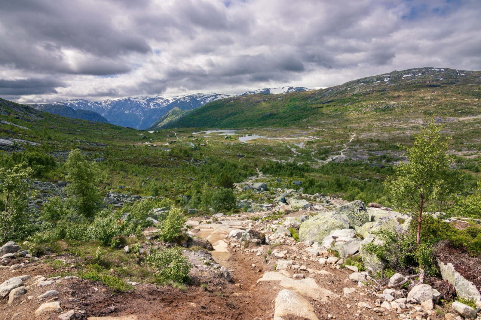
From P3 it is another 10 km to Trolltunga. At first the trail is fairly level, following a gentle upland valley. After about 45 minutes it climbs steeply up a long rocky slope to the Gryteskaret pass. The destination company calls this perhaps the most challenging part of the hike, and it is where you will be glad you started early, with fresh legs. At the top is a five-metre-high boulder that is almost buried by snow in winter.
Trombeskar and Store Floren
Another steep climb brings you up to the Trombeskar pass and a grassy valley that is popular with campers. The trail runs along the shore of a small lake, then drops gently to Store Floren, where the view opens over Ringedalsvatnet, far below. At Store Floren there is an emergency shelter, stocked with sleeping bags, blankets and food rations for anyone caught out by a storm.
The name tells a story. The trail follows part of an ancient route between western and eastern Norway across the Hardangervidda plateau, and this area was used as summer pasture. When the hydropower works were built in Tyssedal and the mountains above in the early 1900s, horses carried the materials up here; you may see the remains of old stables.
Across the plateau
Once on the plateau you are at an altitude of about 900 metres. The terrain is flatter but still rough, with many short ups and downs, and the major climbs are behind you. The trail crosses Hestaflåene, an old grazing ground for horses. Use the bridges to cross Endåen and the other riverbeds, whether or not they have water in them, and stay on the trail: the alpine vegetation up here is fragile. A second emergency shelter stands at Endåen.
Even towards the end of June there may still be snow on this stretch in some years. Sturdy boots, sunglasses and high-factor sunscreen are worth packing for that reason alone.
Endanuten, Tyssehøl and the lost waterfall
The trail climbs steeply again to Endanuten. A little further on, at Tyssehøl, you cross a riverbed that once fed Tyssestrengene, a twin waterfall that was Norway’s highest, with a total height of 646 metres and a 312-metre free fall. In the nineteenth century it was one of the country’s premier tourist attractions. In 1967 its water was diverted to the Tysso II hydropower plant, and the riverbed you walk across is what remains. You also pass a dam, from which the water now runs through tunnels to the turbines.
The ledge
As the trail narrows near the end, the drop beside it becomes serious. Then Trolltunga comes into view: a slab of rock jutting out 700 metres above Ringedalsvatnet, with the Folgefonna glacier in the background on a clear day. (Store norske leksikon, Norway’s national encyclopedia, puts it about 800 vertical metres above the lake’s lowest water level; the lake is a hydropower reservoir and its level varies.)
Four iron rebar steps lead down onto the ledge itself. There are no fences anywhere around Trolltunga, and the cliffs are sheer. Stay well back from the edge, and do not walk out in fog.
When to go: the seasons
| Season | Months | What to expect |
|---|---|---|
| Summer | June to August | Long, bright days; the main season for hiking on your own |
| Autumn | September to October | Shorter days; snow can settle as early as mid-October |
| Winter | November to February | Snow, ice and short days; guided tours only |
| Spring | March to May | The path is often under snow until May or June; guided tours recommended |
The sources do not all draw the line in the same place. The destination company says experienced hikers can go on their own from 1 June to 30 September. Visit Norway gives the main hiking season as 1 June to 31 August and says to always go with a guide from 1 October to 31 May. The regional tourism board goes further and says that outside the summer season you have to go with a guide. We follow the destination company, which runs the trail, but the safe reading is the same in each case: from October to May, go with a guide.
Daylight is the other constraint. At Trolltunga it varies from almost 19 hours in summer to less than 6 hours in winter. In September and October that means starting early and carrying a headlamp, even if you expect to be down before dark.
Autumn has a lot going for it: fewer people, and the mountains turn red, yellow and orange. The days are shorter, though, so start early and keep an eye on the time.
The weather rule
The rule from the destination company is short: never hike to Trolltunga in strong wind, heavy rain or fog. It is always colder on the mountain than down by the fjord, and the weather can change quickly even on a sunny morning.
Visit Norway recommends allowing at least two days in the area, to improve your chance of a good one. That is the single best piece of planning advice for Trolltunga. If the forecast for your planned day is poor, a spare day lets you wait rather than set out in conditions you should not be in. Every year there are rescues of hikers who were poorly equipped or not well enough prepared.
Start times, crowds and the photo queue
Trolltunga is busiest between 12:00 and 15:00 from about 20 June to 20 August, and most crowded on Saturdays and on the first sunny day after a spell of rain. At midday on weekdays the wait for the photo on the ledge is 30–45 minutes; on Saturdays it can be 60–90 minutes. There is little or no queue early in the morning or later in the afternoon.
Visit Norway advises starting before 8 am to be sure of getting back before dark. That also keeps you ahead of the midday peak at the ledge. If you are using the shuttle, the last bus down from P3 leaves at 19:00, so an early start is not optional.
While you wait, keep the turns short: a few poses each, and offer to take photos for the people next to you. If you would rather not climb down onto the ledge, someone can photograph you on the cliff with Trolltunga behind you.
What to carry
Visit Norway suggests a 30-litre backpack, which is about the minimum for everything you need on a full day in the mountains. The core list:
- Footwear. Hiking boots, not trainers. You walk through wet marsh, mud and water in several places.
- Layers. A wool base layer, an insulating mid layer such as a fleece or synthetic jacket, and windproof, waterproof outerwear, plus an extra set of clothes, a hat and gloves. Wool keeps you warm even when wet; cotton does not.
- Food. More than you think. The destination company advises eating about every two hours.
- Navigation and safety. A map and compass, a first-aid kit, a fully charged phone and a headlamp.
- Sun protection. Sunglasses and high-factor sunscreen, especially where there is snow.
Gear can be rented from Trolltunga Active in Skjeggedal if you have travelled light.
Water, toilets and rubbish
You can fill water bottles at the P2 car park in Skjeggedal. Many hikers refill from streams on the mountain, but the destination company says not to do so until the first emergency shelter just before Floren, about halfway to Trolltunga, and to avoid filling near Trolltunga itself or near the cabin areas. The water is not tested, and running streams are better than lakes.
There are no public toilets along the trail, so use the ones at the car parks before you start. On the mountain, keep well away from streams and lakes and downhill from the trail. Everything you carry up comes back down with you, including used toilet paper, to the bins at the car park.
Safety on the trail
The hike is much safer than it was a decade ago, and the reason is a deliberate system:
- Mountain rangers. The ranger cabin is staffed around the clock from about 17 May to mid-October, and a ranger walks out to the ledge around midday to organise the queue.
- Emergency shelters. There are three on the trail, at Floren, Endåen and Tyssehøl, with sleeping bags, blankets and emergency supplies. They are for emergencies, not overnight stays.
- Phone coverage. There is mobile coverage along most of the trail.
- Emergency number. If you are hurt or in a serious emergency, call 112. Emergency services in Norway cost nothing.
The history explains the effort. Visitor numbers rose from 800 in 2010 to 87,000 in 2018, and around 80,000 people now make the hike each year, most of them from abroad. In 2016 there were 42 rescue operations. The mountain patrol system followed in 2017, and in 2023 a new emergency shelter opened near Trolltunga itself. At the end of July 2021 the trail was certified as a Norwegian Scenic Hike.
The ranger service also has advice for groups: stay on the trail and keep together. It is much easier to find a group that has stayed in one place than individuals scattered across the mountain.
Dogs, drones and camping
Dogs are welcome but must be kept on a leash between 1 April and 31 October in Ullensvang, and all year in the cabin areas at Åsen and Mågelitopp. Drones are strongly discouraged; if you fly one, follow Norway’s drone rules and never fly while people are on the ledge.
Camping on the mountain is allowed, but not near the car parks or the trailhead. Pitch at one of the sites marked with a tent symbol on the trail map, downhill from the trail and well away from streams and lakes, and on bare rock where you can. Open fires are prohibited between 15 April and 15 September, so bring a stove. Our guide to overnight and guided tours covers the alternatives to carrying a tent yourself.
Hiking with a guide
In summer a guide is optional for experienced hikers, but the destination company recommends one, especially if you have limited mountain experience. Two local companies, Trolltunga Active and Trolltunga Adventures, run guided day hikes.
Trolltunga Active’s guided summer hike is a good example of what you get. It meets at 7:30 am at the operator’s base in Skjeggedal, includes the shuttle from P2 to P3 and back when the weather allows, and is listed at about 10 hours, from NOK 1,550 per person. Even with the shuttle, the walk from P3 can take 7–9 hours. Guides carry safety equipment, take the classic photos of you on the ledge, and decide on the day whether conditions are safe. Trolltunga Adventures runs an all-inclusive day hike from June to October.
From October to May, a guided tour is the way to do the hike at all. Winter trips use snowshoes or microspikes and are graded much harder. The tours page lists the current guided hikes.
Frequently asked questions
How long does the Trolltunga hike take?
From P3 Mågelitopp the 20 km round trip takes 7–10 hours; from P2 Skjeggedal the 27 km round trip takes 8–12 hours. Add time for the queue at the ledge in peak season.
How difficult is the Trolltunga hike?
It is graded Very Demanding because it is over 20 km long. The trail is in good condition, but you need good fitness, endurance and some experience of mountain terrain.
Can I hike Trolltunga on my own in October?
The destination company recommends a guided hike outside 1 June to 30 September, and Visit Norway says to always go with a guide from 1 October to 31 May. Snow can settle as early as mid-October.
Is there drinking water on the trail?
Fill up at the P2 car park. On the mountain, the destination company says not to fill from streams until the first emergency shelter just before Floren, about halfway, and notes that the water is not tested.
Can children hike to Trolltunga?
The destination company recommends that everyone on the hike is at least 12 years old, fit and used to long walks. It advises strongly against taking infants and toddlers.
Is there mobile signal at Trolltunga?
There is mobile coverage along most of the trail. In an emergency, call 112.